
If you follow me regularly, you’ll know I love exploring new places with my dog—and I’m always on the lookout for tools that make planning and enjoying those walks easier.
One app I rely on time and time again is the Ordnance Survey Maps app. Whether I’m heading off on a countryside trail or plotting a new coastal route, this app is a total game-changer. Here’s why it’s become my go-to for dog-friendly adventures across the UK.
Detailed and Accurate Information at Your Fingertips
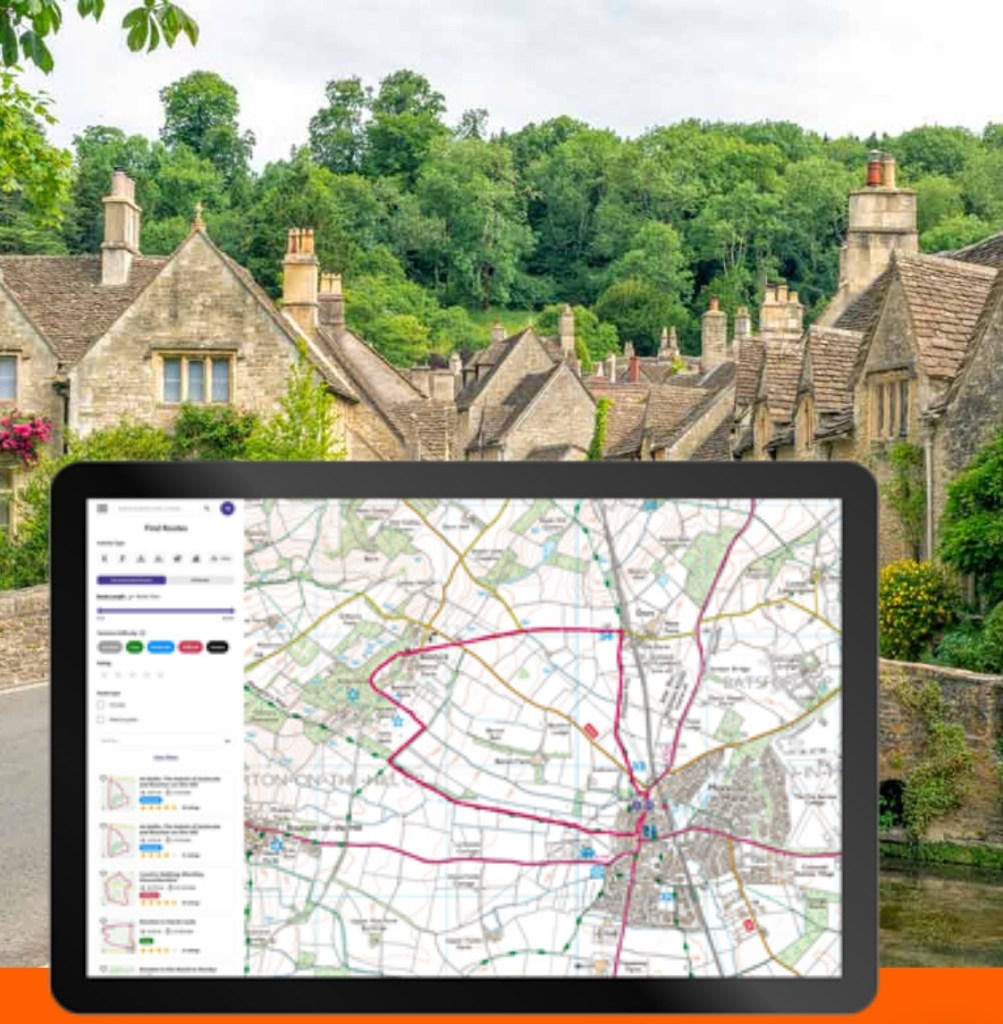
There’s nothing worse than arriving at a new walk and not being quite sure where you’re going. With the OS Maps app, I have access to incredibly detailed and accurate maps right on my phone. From public footpaths and bridleways to terrain and elevation, the app makes it easy to get a clear sense of what the walk will be like—no surprises, just good walks.
Plus it covers the whole of the UK, so you’ll be able to view maps no matter where you’re going.
Plan and Save Routes with Ease
One of my favourite features is how easy it is to plan routes. You can tap to plot your path, and the app will instantly show you the distance and how long it’s likely to take. This is such a helpful feature when planning walks with a dog (and now a baby in tow!)—it means I know exactly what to expect and can plan around nap times, feeding, or just how much energy we all have.
Easy to Share Walks
I save all of my favourite routes in the app, and many of them are shared in the Walking highlights at the top of my Instagram page. It makes it really easy for me to help others discover dog-friendly routes I’ve loved, and it means everything is stored in one place when I want to revisit them. Whether you want to share a new favourite with friends or create your own collection, it’s super simple to do.
Follow Routes in Real Time
Once you’re out walking, you can use the app to follow your route in real time. It shows you exactly where you are on the trail, which is so reassuring when you’re somewhere new or less clearly signposted. It’s like having a personal guide in your pocket, making it super easy to stay on track (especially useful if you’ve got a dog pulling you toward every interesting smell).
Offline Mode – No Signal? No Problem

How many times have you lost signal halfway through a walk? With the OS Maps app, you can download routes in advance and use them completely offline. It means no more flapping paper maps in the wind, and no panic when the signal drops—just calm, confident navigation wherever you are.
See what it’s really like with 3D mode

If you’re a bit of a worrier like me, being able to see exactly what somewhere is like before you get there can be a game changer. OS maps has an aerial 3D layer, which means you can get a good understanding of the terrain, find the best viewpoints and more.
One Word of Advice
As brilliant as the app is, I always recommend having a backup with you—just in case your phone runs out of battery or has a tech hiccup. A paper map of the area and/or a charged power bank can be real lifesavers. It’s all about being prepared so you can enjoy your walk with peace of mind.
If you haven’t tried the OS Maps app yet, I can’t recommend it enough. It’s been a huge help in planning, saving, and sharing the best dog-friendly walks—and it’s made our adventures even more enjoyable.
Click here to download the OS Maps app (affiliate link) and start planning your next dog-friendly adventure today!

Leave a comment